1971 Map of Ragland
USGS Topo · Published 1974About this map
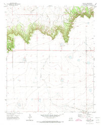
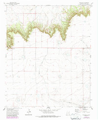
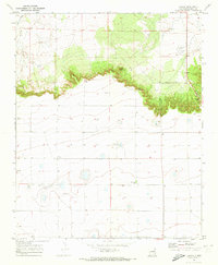
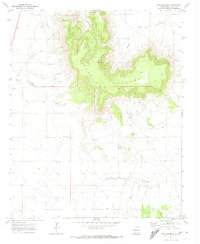
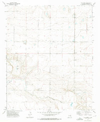
Ragland Hill dominates the western edge of this High Plains landscape, where the escarpment drops away from the level mesa top. The small settlement of Ragland sits at the base of this prominent rise, serving as a focal point in a territory defined by deep drainage patterns like Norton Canyon and Barranca Creek. This 1971 survey reveals a landscape of sparse human intervention, primarily organized around water access and cattle ranching. Evidence of early family history can be traced to the Prater Cem located west of Blanco Creek. The map shows the transition from the flat tableland to the broken terrain of the draws, with Frio Draw cutting through the northeast corner. Infrastructure is minimal, represented by scattered stock tanks, a solitary Well, and a prominent Radio Tower that stands as a modern landmark above the canyon breaks.
Find a feature on this map
10 named features on this map. Tap any name to fly to it.
Don’t see what you’re looking for? This feature index may not catch every label — zoom into the map to look around manually.
Map Details
Editions of this 1971 Ragland Map
2 editions found
Other maps of this area

1954 · Clovis
USGS Topo · 1:250,000

1958 · Clovis
USGS Topo · 1:250,000
1970 · Jordan
USGS Topo · 1:24,000
1970 · Quay
USGS Topo · 1:24,000
1971 · Mesa Redonda
USGS Topo · 1:24,000
1971 · Norton
USGS Topo · 1:24,000
1971 · Forrest
USGS Topo · 1:24,000
1973 · Weber City
USGS Topo · 1:24,000
1973 · Mc Alister
USGS Topo · 1:24,000
1973 · Field
USGS Topo · 1:24,000