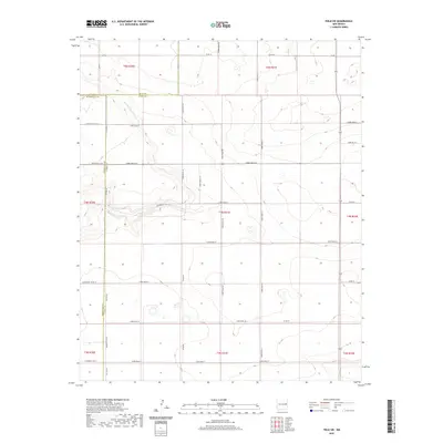
2020 Map of Field SW
USGS Topo · Published 2020About this map
Alamosa Cr meanders through a landscape defined by the intersection of three eastern New Mexico counties. This High Plains terrain is characterized by a precise grid of rural transit, where Quay Co, Roosevelt Co, and Curry Co meet at a jurisdictional tri-point. The area is dominated by agricultural section lines and an extensive network of named local routes, including Curry Road 22 and N Roosevelt Road 19. This modern survey illustrates the enduring nature of the Public Land Survey System in the region, showing how contemporary infrastructure like New Mexico 89 follows the historical boundaries established by the township and range system. The map serves as a detailed record of land division and rural access in a sparsely populated corner of the state, centered on the boundary marked by Co Line Rd.
Find a feature on this map
38 named features on this map. Tap any name to fly to it.
Don’t see what you’re looking for? This feature index may not catch every label — zoom into the map to look around manually.
Map Details
Editions of this 2020 Field SW Map
This is the sole edition of this map. No revisions or reprints were ever made.
Other maps of this area

1954 · Clovis
USGS Topo · 1:250,000

1957 · Melrose
USGS Topo · 1:62,500

1958 · Clovis
USGS Topo · 1:250,000

1972 · Melrose East
USGS Topo · 1:24,000

1973 · Weber City
USGS Topo · 1:24,000

1973 · Krider
USGS Topo · 1:24,000

1973 · Field SE
USGS Topo · 1:24,000

1973 · Melrose West
USGS Topo · 1:24,000

1973 · Mc Alister
USGS Topo · 1:24,000

1973 · Field SW
USGS Topo · 1:24,000