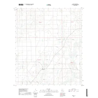
2018 Map of Fields
USGS Topo · Published 2018About this map
Fields serves as the central settlement in this portion of Beauregard Parish, situated at the junction of several rural routes including Turkey Rd and Jacobs Rd. The landscape is defined by an intricate drainage system typical of the southwest Louisiana pine woods, where numerous gullies and creeks like Bear Head Cr and White Oak Gully carve through the terrain. The presence of Spikes Lake and the Blixthn Marsh suggests a low-lying, water-rich environment that influenced the placement of early homesteads and timber operations.
Find a feature on this map
39 named features on this map. Tap any name to fly to it.
Don’t see what you’re looking for? This feature index may not catch every label — zoom into the map to look around manually.
Map Details
Editions of this 2018 Fields Map
This is the sole edition of this map. No revisions or reprints were ever made.
Other maps of this area

1935 · Wilson Lake
USGS Topo · 1:31,680

1947 · Singer
USGS Topo · 1:31,680

1947 · Carter Creek
USGS Topo · 1:31,680

1947 · DeQuincy
USGS Topo · 1:31,680

1947 · Oretta
USGS Topo · 1:31,680

1947 · Wilson Lake
USGS Topo · 1:31,680

1947 · Hyatt
USGS Topo · 1:31,680

1947 · Bivens
USGS Topo · 1:31,680

1947 · Long Marsh
USGS Topo · 1:31,680

1949 · Bancroft
USGS Topo · 1:31,680