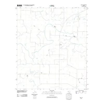
2010 Map of Fife
USGS Topo · Published 2010About this map
The Colorado River meanders across this rural McCulloch County landscape, defining the character of the ranchlands and small communities at the start of the 21st century. The map centers on the small settlement of Waldrip and the nearby Fife to the southeast, connected by a network of ranch roads like Ranch Rd 765. Evidence of early Texas transport and settlement is found at historic river fords such as Hays Crossing and Chaffin Crossing.
Find a feature on this map
36 named features on this map. Tap any name to fly to it.
Don’t see what you’re looking for? This feature index may not catch every label — zoom into the map to look around manually.
Map Details
Editions of this 2010 Fife Map
This is the sole edition of this map. No revisions or reprints were ever made.
Other maps of this area

1887 · Coleman
USGS Topo · 1:125,000

1889 · Coleman
USGS Topo · 1:125,000

1892 · Eden
USGS Topo · 1:125,000

1892 · Ballinger
USGS Topo · 1:125,000

1894 · Brady
USGS Topo · 1:125,000

1896 · Eden
USGS Topo · 1:125,000

1924 · Eden 1-a
USGS Topo · 1:48,000

1924 · Brady 2-a
USGS Topo · 1:48,000

1925 · Brady 2-b
USGS Topo · 1:48,000

1928 · Waldrip
USGS Topo · 1:62,500