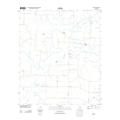
2013 Map of Fife
USGS Topo · Published 2013About this map
The Colorado River defines the heart of this landscape in northern McCulloch County, creating a natural corridor where early crossings and small settlements once anchored the local community. Near the river's bend, the locations of Hays Crossing and Chaffin Crossing point to a time when river fords were essential transit points for residents of Waldrip and the surrounding ranchlands. The landscape is carved by numerous drainage patterns, including Rough Hollow, Public Hollow, and Yoho Hollow, which feed into tributaries like Bull Cr and Little Bull Cr.
Find a feature on this map
43 named features on this map. Tap any name to fly to it.
Don’t see what you’re looking for? This feature index may not catch every label — zoom into the map to look around manually.
Map Details
Editions of this 2013 Fife Map
This is the sole edition of this map. No revisions or reprints were ever made.
Other maps of this area

1887 · Coleman
USGS Topo · 1:125,000

1889 · Coleman
USGS Topo · 1:125,000

1892 · Eden
USGS Topo · 1:125,000

1892 · Ballinger
USGS Topo · 1:125,000

1894 · Brady
USGS Topo · 1:125,000

1896 · Eden
USGS Topo · 1:125,000

1924 · Eden 1-a
USGS Topo · 1:48,000

1924 · Brady 2-a
USGS Topo · 1:48,000

1925 · Brady 2-b
USGS Topo · 1:48,000

1928 · Waldrip
USGS Topo · 1:62,500