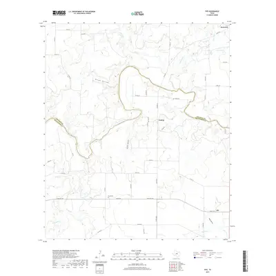
2019 Map of Fife
USGS Topo · Published 2019About this map
The Colorado River snakes through the heart of this Central Texas landscape, defining the jagged border between Coleman and McCulloch counties. The small settlement of Waldrip sits on the southern bank, north of Ranch Road 765, which serves as a primary east-west artery through the region. To the southeast lies the community of Fife, while Rockwood occupies the northeastern corner of the map. These rural outposts are connected by a network of county roads that navigate the local topography of drainages and basins.
Find a feature on this map
49 named features on this map. Tap any name to fly to it.
Don’t see what you’re looking for? This feature index may not catch every label — zoom into the map to look around manually.
Map Details
Editions of this 2019 Fife Map
This is the sole edition of this map. No revisions or reprints were ever made.
Other maps of this area

1887 · Coleman
USGS Topo · 1:125,000

1889 · Coleman
USGS Topo · 1:125,000

1892 · Eden
USGS Topo · 1:125,000

1892 · Ballinger
USGS Topo · 1:125,000

1894 · Brady
USGS Topo · 1:125,000

1896 · Eden
USGS Topo · 1:125,000

1924 · Eden 1-a
USGS Topo · 1:48,000

1924 · Brady 2-a
USGS Topo · 1:48,000

1925 · Brady 2-b
USGS Topo · 1:48,000

1928 · Waldrip
USGS Topo · 1:62,500