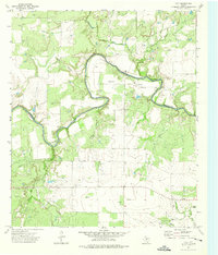
1973 Map of Fife
USGS Topo · Published 1976About this map
The Colorado River meanders sharply through this Central Texas landscape, defining the boundary between Coleman and McCulloch counties. The small settlement of Waldrip sits north of the river, while the surrounding area is characterized by a network of drainage hollows and creek systems including Bull Creek, Little Saddle Creek, and Yoho Hollow. The land use of the early 1970s is clearly visible through the presence of numerous Gas Well sites and several Gravel Pits, including the uniquely named Steer Pit in the northwest. Local historical interest is anchored by traditional river access points such as Hays Crossing and Chaffin Crossing. Family and community history is preserved at the Marion Cem and Chaffin Cem, providing essential points of reference for genealogists studying this rural riverfront corridor.
Find a feature on this map
22 named features on this map. Tap any name to fly to it.
Don’t see what you’re looking for? This feature index may not catch every label — zoom into the map to look around manually.
Map Details
Editions of this 1973 Fife Map
This is the sole edition of this map. No revisions or reprints were ever made.
Other maps of this area

1887 · Coleman
USGS Topo · 1:125,000

1889 · Coleman
USGS Topo · 1:125,000

1892 · Eden
USGS Topo · 1:125,000

1892 · Ballinger
USGS Topo · 1:125,000

1894 · Brady
USGS Topo · 1:125,000

1896 · Eden
USGS Topo · 1:125,000

1924 · Eden 1-a
USGS Topo · 1:48,000

1924 · Brady 2-a
USGS Topo · 1:48,000

1925 · Brady 2-b
USGS Topo · 1:48,000

1928 · Waldrip
USGS Topo · 1:62,500