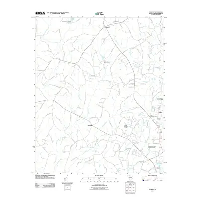
2011 Map of Filbert
USGS Topo · Published 2011About this map
The Beersheba and Bethany communities define the rural character of York County during this 2011 survey, where agricultural land and residential roads intersect a dense network of watercourses. The landscape is heavily dissected by the headwaters of Bullock Creek, Allison Creek, and Turkey Creek, which flow toward man-made landmarks like Adams Lake and several numbered dams. Near the eastern edge, the village of Filbert serves as a local hub, situated near Kings Mountain Church and the extensive grounds of Lakeview Memory Gardens. The presence of the York Airport and the specialized Bush-N-Vine Farm illustrates the mix of traditional land use and modern infrastructure. This period shows a well-connected rural interior where old family-named routes like L H Hicks Rd and Maynard Grayson Rd weave between the creeks, supporting a community anchored by the Upper York Reservoir.
Find a feature on this map
132 named features on this map. Tap any name to fly to it.
Don’t see what you’re looking for? This feature index may not catch every label — zoom into the map to look around manually.
Map Details
Editions of this 2011 Filbert Map
This is the sole edition of this map. No revisions or reprints were ever made.
Other maps of this area

1906 · Kings Mountain
USGS Topo · 1:62,500

1907 · Sharon
USGS Topo · 1:62,500

1908 · Kings Mountain
USGS Topo · 1:62,500

1941 · Spartanburg
USGS Topo · 1:250,000

1947 · Clover
USGS Topo · 1:62,500

1949 · Clover
USGS Topo · 1:62,500

1949 · Rock Hill
USGS Topo · 1:62,500

1953 · Spartanburg
USGS Topo · 1:250,000

1953 · Charlotte
USGS Topo · 1:250,000

1954 · Charlotte
USGS Topo · 1:250,000