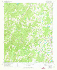
1971 Map of Filbert
USGS Topo · Published 1973About this map
The northwest corner of York County is anchored by Kings Mountain State Park, where the landscape is defined by the drainage of Long Fork and Clark Fork feeding into Lake York. This 1971 topographic survey illustrates a rural community built around agriculture and small-scale industry, evidenced by a Quarry near Filbert and a Sandpit further south. The Carolina and Northwestern railroad line serves as a central spine through the eastern portion of the quadrangle, passing through Filbert and nearing the northern outskirts of York.
Find a feature on this map
32 named features on this map. Tap any name to fly to it.
Don’t see what you’re looking for? This feature index may not catch every label — zoom into the map to look around manually.
Map Details
Editions of this 1971 Filbert Map
This is the sole edition of this map. No revisions or reprints were ever made.
Other maps of this area

1906 · Kings Mountain
USGS Topo · 1:62,500

1907 · Sharon
USGS Topo · 1:62,500

1908 · Kings Mountain
USGS Topo · 1:62,500

1941 · Spartanburg
USGS Topo · 1:250,000

1947 · Clover
USGS Topo · 1:62,500

1949 · Clover
USGS Topo · 1:62,500

1949 · Rock Hill
USGS Topo · 1:62,500

1953 · Spartanburg
USGS Topo · 1:250,000

1953 · Charlotte
USGS Topo · 1:250,000

1954 · Charlotte
USGS Topo · 1:250,000