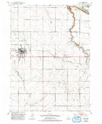
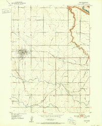
1950 Map of Filer
USGS Topo · Published 1992About this map
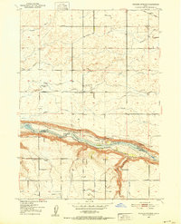
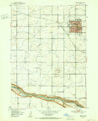
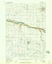
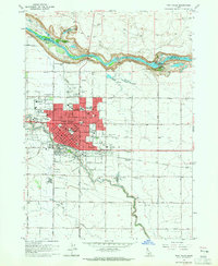
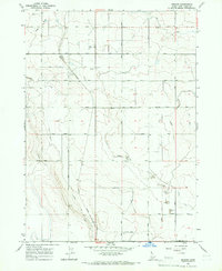
Filer serves as the focal point for this agricultural region of southern Idaho, situated between the wide expanses of Sucker Flat to the north and the deep incision of Deadman Gulch to the southeast. The landscape is defined by its complex irrigation and water management systems, including an Abandoned Ditch and the reservoir at Cedar Draw Lake. The presence of the County Fairgrounds and the IOOF Cem in Filer indicates a well-established community center, while outlying hamlets like Godwin, Knull, and Curry trace the patterns of early 20th-century rural settlement. To the east, the terrain drops sharply toward the Snake River canyon, where the Rock Creek Park and nearby Powerhouse reflect the dual utility of the river for both recreation and industry. This map reveals a transition from the intensive cultivation near Filer to the specialized operations at the Mink Farm and various feedlots along the canyon rim.
Find a feature on this map
41 named features on this map. Tap any name to fly to it.
Don’t see what you’re looking for? This feature index may not catch every label — zoom into the map to look around manually.
Map Details
Editions of this 1950 Filer Map
2 editions found
Other maps of this area
1950 · Niagara Springs
USGS Topo · 1:24,000
1950 · Filer
USGS Topo · 1:24,000
1950 · Jerome
USGS Topo · 1:24,000
1950 · Jerome
USGS Topo · 1:62,500
1951 · Clover
USGS Topo · 1:24,000

1955 · Twin Falls
USGS Topo · 1:250,000

1958 · Twin Falls
USGS Topo · 1:250,000
1964 · Falls City
USGS Topo · 1:24,000
1964 · Twin Falls
USGS Topo · 1:24,000
1965 · Berger
USGS Topo · 1:24,000