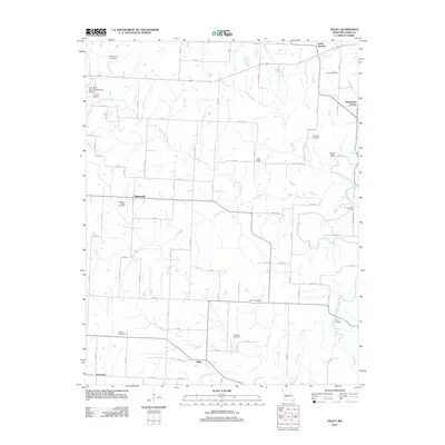
2011 Map of Filley
USGS Topo · Published 2011About this map
Cedar Springs and the surrounding rural landscape of Cedar County appear here as a network of small crossroads communities and family burial grounds. The settlement pattern is defined by clusters like Filley, Willowville, and Hackleman Corner, which are linked by a grid of agricultural roads and creeks. Waterways such as Alder Creek, Horse Creek, and Cherry Branch carve through the terrain, influencing the placement of early homesteads and landmarks like Smith Bluff. Genealogy researchers will find significant value in the distribution of local cemeteries, including Vandenburg Cemetery, Mound Cemetery, and Malcolm Cemetery, which are scattered throughout the countryside. The presence of the El Dorado Springs Memorial Airport in the northwest corner highlights the modernization of transport alongside traditional land use in this Missouri interior.
Find a feature on this map
52 named features on this map. Tap any name to fly to it.
Don’t see what you’re looking for? This feature index may not catch every label — zoom into the map to look around manually.
Map Details
Editions of this 2011 Filley Map
This is the sole edition of this map. No revisions or reprints were ever made.
Other maps of this area

1886 · Nevada
USGS Topo · 1:125,000

1886 · Stockton
USGS Topo · 1:125,000

1894 · Nevada
USGS Topo · 1:125,000

1937 · Tiffin
USGS Topo · 1:31,680

1938 · Roscoe
USGS Topo · 1:24,000

1939 · Caplinger Mills
USGS Topo · 1:24,000

1939 · Eldorado Springs North
USGS Topo · 1:24,000

1939 · Filley
USGS Topo · 1:24,000

1939 · Eldorado Springs South
USGS Topo · 1:24,000

1940 · Roscoe
USGS Topo · 1:24,000