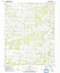
1991 Map of Filley
USGS Topo · Published 1992About this map
Cedar Springs and Willowville anchor a landscape defined by winding watercourses and small rural gathering points in the late 1980s. The topography is shaped by the drainage of Adler Creek, Horse Creek, and the prominent Cedar Creek, which meanders through the eastern portion of the quadrangle. Local life is centered around community hubs like the Hazel Dell Ch and Harriman Ch, while the El Dorado Springs Memorial Airport stands out as a modern landmark in the northwest. Genealogy researchers will find significant value in the distribution of family-named burial grounds and settlements such as Pacetown and Hackleman Corner. From the Mound Cem to the Vandenburg Cem, the map documents a network of rural roads connecting established farms and cemeteries that remain central to the identity of this Missouri region.
Find a feature on this map
32 named features on this map. Tap any name to fly to it.
Don’t see what you’re looking for? This feature index may not catch every label — zoom into the map to look around manually.
Map Details
Editions of this 1991 Filley Map
This is the sole edition of this map. No revisions or reprints were ever made.
Other maps of this area

1886 · Nevada
USGS Topo · 1:125,000

1886 · Stockton
USGS Topo · 1:125,000

1894 · Nevada
USGS Topo · 1:125,000

1937 · Tiffin
USGS Topo · 1:31,680

1938 · Roscoe
USGS Topo · 1:24,000

1939 · Caplinger Mills
USGS Topo · 1:24,000

1939 · Eldorado Springs North
USGS Topo · 1:24,000

1939 · Filley
USGS Topo · 1:24,000

1939 · Eldorado Springs South
USGS Topo · 1:24,000

1940 · Roscoe
USGS Topo · 1:24,000