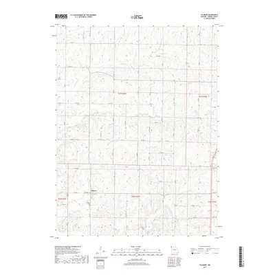
2017 Map of Fillmore
USGS Topo · Published 2017About this map
Fillmore serves as the primary hub for this section of Andrew County, its residential and commercial blocks organized along a modest grid surrounded by an expansive network of rural county roads. The landscape is defined by the dendritic drainage patterns of several local waterways, including Arapahoe Cr and Pedlar Cr, which carve through the terrain before feeding into larger systems. This agricultural region is punctuated by small bodies of water like Dysart Lake, Cole Lake, and Smith Lake, likely serving local drainage or recreation needs. For those researching local history or genealogy, the Fillmore Cem on the outskirts of town provides a specific point of reference for the community's heritage. The map documents the persistent township and range boundaries of the Public Land Survey System, such as t60n r36w, which have dictated land ownership and road placement in this part of Missouri for generations.
Find a feature on this map
68 named features on this map. Tap any name to fly to it.
Don’t see what you’re looking for? This feature index may not catch every label — zoom into the map to look around manually.
Map Details
Editions of this 2017 Fillmore Map
This is the sole edition of this map. No revisions or reprints were ever made.
Other maps of this area

1885 · Atchison
USGS Topo · 1:125,000

1888 · Atchison
USGS Topo · 1:125,000

1893 · Atchison
USGS Topo · 1:125,000

1924 · St. Joseph
USGS Topo · 1:62,500

1926 · Saint Joseph
USGS Topo · 1:62,500

1926 · Oregon
USGS Topo · 1:62,500

1926 · Maitland
USGS Topo · 1:62,500

1927 · Bolckow
USGS Topo · 1:62,500

1945 · Bolckow
USGS Topo · 1:62,500

1950 · Kansas City
USGS Topo · 1:250,000