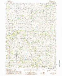
1984 Map of Fillmore
USGS Topo · Published 1985About this map
Fillmore serves as the primary hub of this Andrew County agricultural landscape, surrounded by a complex network of waterways that define the local drainage patterns. Significant water features including Owl Creek, Newland Creek, and Arapahoe Creek carve through the townships of Clay, Benton, and Jackson. This 1980s-era topographical detail highlights the rural infrastructure of the period, from the Wooden Pole Trans Line and a local Substation to several small aviation sites such as the Furst Landing Strip and another unnamed Landing Strip. Local genealogy is anchored by scattered Cemeteries and the established boundaries of Nodaway township, while the meandering course of Pedlar Creek and Lincoln Creek illustrates the undulating terrain of the Missouri countryside before late-century development shifted the land-use patterns.
Find a feature on this map
15 named features on this map. Tap any name to fly to it.
Don’t see what you’re looking for? This feature index may not catch every label — zoom into the map to look around manually.
Map Details
Editions of this 1984 Fillmore Map
This is the sole edition of this map. No revisions or reprints were ever made.
Other maps of this area

1885 · Atchison
USGS Topo · 1:125,000

1888 · Atchison
USGS Topo · 1:125,000

1893 · Atchison
USGS Topo · 1:125,000

1924 · St. Joseph
USGS Topo · 1:62,500

1926 · Saint Joseph
USGS Topo · 1:62,500

1926 · Oregon
USGS Topo · 1:62,500

1926 · Maitland
USGS Topo · 1:62,500

1927 · Bolckow
USGS Topo · 1:62,500

1945 · Bolckow
USGS Topo · 1:62,500

1950 · Kansas City
USGS Topo · 1:250,000