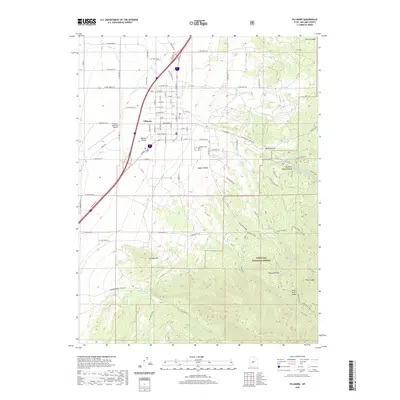
2020 Map of Fillmore
USGS Topo · Published 2020About this map
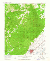
Fillmore serves as the focal point of this Millard County landscape, situated where the irrigated agricultural flats of the Pahvant Valley meet the rising foothills of the Pahvant Range. The town's grid is meticulously detailed, extending from N Main St to outlying infrastructure like the Fillmore Municipal Airport. To the east, the terrain shifts abruptly into the Fishlake National Forest, a region defined by steep canyons and seasonal watercourses such as Chalk Creek and Meadow Creek. Genealogists and local historians can locate the Fillmore Cem on the town's eastern edge, near the mouth of Maple Hollow. This transition from the structured valley floor to the high-elevation forest highlights the vital relationship between the settlement and its mountain water sources, exemplified by labels for Watercress Spring and Ruths Pond tucked within the ridges.
Find a feature on this map
92 named features on this map. Tap any name to fly to it.
Don’t see what you’re looking for? This feature index may not catch every label — zoom into the map to look around manually.
Map Details
Editions of this 2020 Fillmore Map
This is the sole edition of this map. No revisions or reprints were ever made.
Other maps of this area
1885 · Beaver
USGS Topo · 1:250,000
1885 · Sevier Desert
USGS Topo · 1:250,000

1953 · Richfield
USGS Topo · 1:250,000
1953 · Delta
USGS Topo · 1:250,000

1958 · Richfield
USGS Topo · 1:250,000
1958 · Delta
USGS Topo · 1:250,000
1960 · Meadow
USGS Topo · 1:24,000
1961 · Fillmore
USGS Topo · 1:24,000
1961 · Mt. Catherine
USGS Topo · 1:24,000
1961 · Richfield
USGS Topo · 1:62,500