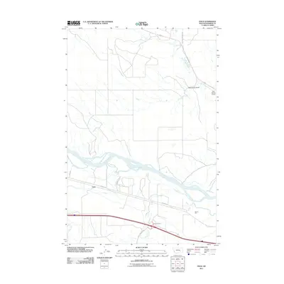
2011 Map of Finch
USGS Topo · Published 2011About this map
The Yellowstone River serves as the dominant geographical feature of this Rosebud County landscape, weaving through a valley marked by small settlements and drainage networks. The settlement of Finch is situated along the northern bank of the river, connected by Frontage Rd and Rte 311. To the east, Maudru Spur identifies a specific point of interest along the rail and road corridor.
Find a feature on this map
15 named features on this map. Tap any name to fly to it.
Don’t see what you’re looking for? This feature index may not catch every label — zoom into the map to look around manually.
Map Details
Editions of this 2011 Finch Map
This is the sole edition of this map. No revisions or reprints were ever made.
Other maps of this area

1954 · Forsyth
USGS Topo · 1:250,000

1957 · Forsyth
USGS Topo · 1:250,000

1958 · Forsyth
USGS Topo · 1:250,000

1960 · Vananda
USGS Topo · 1:24,000

1960 · Sanders
USGS Topo · 1:24,000

1968 · Donleys Reservoir
USGS Topo · 1:24,000

1968 · Nichols
USGS Topo · 1:24,000

1968 · Finch NE
USGS Topo · 1:24,000

1968 · Finch
USGS Topo · 1:24,000

1971 · Griffin Coulee NE
USGS Topo · 1:24,000