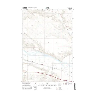
2017 Map of Finch
USGS Topo · Published 2017About this map
The Yellowstone River cuts a wide, braided path through this Rosebud County landscape, anchoring a valley of agricultural settlements and transport corridors. Along the southern bank, the communities of Finch, Hammond Valley, and Howard Valley follow the fertile bottomlands, linked by the historic path of Old Hwy 10 and the modern Frontage Rd. This 2017 survey reveals a complex network of named coulees and creek drainages that feed the river from the north and south, including Big Porcupine Cr and Reservation Creek.
Find a feature on this map
29 named features on this map. Tap any name to fly to it.
Don’t see what you’re looking for? This feature index may not catch every label — zoom into the map to look around manually.
Map Details
Editions of this 2017 Finch Map
This is the sole edition of this map. No revisions or reprints were ever made.
Other maps of this area

1954 · Forsyth
USGS Topo · 1:250,000

1957 · Forsyth
USGS Topo · 1:250,000

1958 · Forsyth
USGS Topo · 1:250,000

1960 · Vananda
USGS Topo · 1:24,000

1960 · Sanders
USGS Topo · 1:24,000

1968 · Donleys Reservoir
USGS Topo · 1:24,000

1968 · Nichols
USGS Topo · 1:24,000

1968 · Finch NE
USGS Topo · 1:24,000

1968 · Finch
USGS Topo · 1:24,000

1971 · Griffin Coulee NE
USGS Topo · 1:24,000