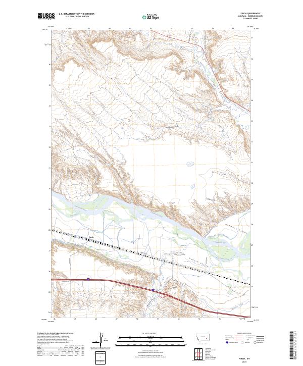
2024 Map of Finch
USGS Topo · Published 2024About this map
The Yellowstone River cuts a wide, fertile path through this portion of Rosebud County, defining the agricultural and transport corridor of the region. The small settlement of Finch sits at the nexus of the valley's infrastructure, where the Yellowstone Canal parallels the river to support local irrigation. This map illustrates the intersection of mid-century infrastructure and earlier travel routes, featuring the path of Old Hwy 10 as it traces the riverbank through Howard Valley. North of the river, the terrain shifts abruptly into the broken landscape of West Spring Coulee and the drainage of Big Porcupine Creek, highlighting the contrast between the developed river bottom and the more varied upland topography. Genealogists and local historians will find the Howard Cem particularly notable, as it remains a quiet landmark of the community's early residents near Reservation Creek.
Find a feature on this map
26 named features on this map. Tap any name to fly to it.
Don’t see what you’re looking for? This feature index may not catch every label — zoom into the map to look around manually.
Map Details
Editions of this 2024 Finch Map
This is the sole edition of this map. No revisions or reprints were ever made.
Other maps of this area

1954 · Forsyth
USGS Topo · 1:250,000

1957 · Forsyth
USGS Topo · 1:250,000

1958 · Forsyth
USGS Topo · 1:250,000

1960 · Vananda
USGS Topo · 1:24,000

1960 · Sanders
USGS Topo · 1:24,000

1968 · Donleys Reservoir
USGS Topo · 1:24,000

1968 · Nichols
USGS Topo · 1:24,000

1968 · Finch NE
USGS Topo · 1:24,000

1968 · Finch
USGS Topo · 1:24,000

1971 · Griffin Coulee NE
USGS Topo · 1:24,000