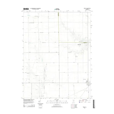
2015 Map of Findlay
USGS Topo · Published 2015About this map
Findlay occupies the southeastern corner of this central Illinois landscape, situated at the intersection of North Wright Street and West Division Street. The terrain is defined by the winding paths of Wilborn Creek and Robinson Creek, which carve through the agricultural grid of Shelby and Moultrie counties. This 2015 survey reveals a distribution of family and community landmarks that speak to the area's rural heritage, particularly in the collection of scattered burial grounds such as Prairie Home Cemetery and Brunswick Cemetery. Small-scale aviation also marks the region, evidenced by the presence of the Paul E. Kroenlein Airport and Enoch Airport. North of the main settlement, the locality of Todds Point sits near the county line, maintaining its identity alongside its namesake Todds Point Cemetery in a region predominantly shaped by seasonal creek drainage and section-line roads.
Find a feature on this map
22 named features on this map. Tap any name to fly to it.
Don’t see what you’re looking for? This feature index may not catch every label — zoom into the map to look around manually.
Map Details
Editions of this 2015 Findlay Map
This is the sole edition of this map. No revisions or reprints were ever made.
Other maps of this area

1935 · Sullivan
USGS Topo · 1:48,000

1940 · Sullivan
USGS Topo · 1:62,500

1942 · Shelbyville
USGS Topo · 1:62,500

1946 · Shelbyville
USGS Topo · 1:62,500

1947 · Stewardson
USGS Topo · 1:62,500

1949 · Stewardson
USGS Topo · 1:62,500

1949 · Dalton City
USGS Topo · 1:62,500

1958 · Decatur
USGS Topo · 1:250,000

1961 · Decatur
USGS Topo · 1:250,000

1980 · Middlesworth
USGS Topo · 1:24,000