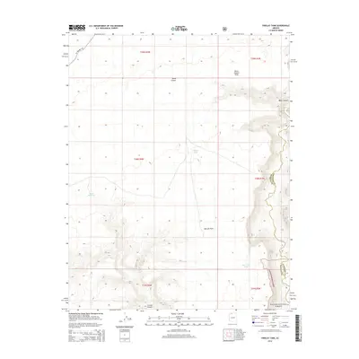
2014 Map of Findlay Tank
USGS Topo · Published 2014About this map
Kaibab National Forest dominates the southeastern quadrant of this landscape, where the high desert is defined by a complex system of drainages and seasonal water sources. The map highlights the essential role of water management in this arid environment, showing man-made infrastructure like Meeks Reservoir, Findlay Tank, and Deer Trail Tank. These features represent the critical points of human and livestock subsistence in a region where the deep incisions of Kanab Cr and Burnt Canyon carve through the plateau. Travel through this remote terrain is anchored by Mt Trumbull Rd in the northwest, providing access to landmarks such as Bulrush Point and Water Canyon. This 2014 survey documents the enduring physical challenges of the Arizona strip, where topographic prominence like Burnt Canyon Point serves as a primary navigational marker across the vast public lands.
Find a feature on this map
18 named features on this map. Tap any name to fly to it.
Don’t see what you’re looking for? This feature index may not catch every label — zoom into the map to look around manually.
Map Details
Editions of this 2014 Findlay Tank Map
This is the sole edition of this map. No revisions or reprints were ever made.
Other maps of this area

1886 · Kaibab
USGS Topo · 1:250,000

1953 · Grand Canyon
USGS Topo · 1:250,000

1954 · Short Creek SE
USGS Topo · 1:24,000

1954 · Heaton Knolls SE
USGS Topo · 1:24,000

1954 · Fredonia SW
USGS Topo · 1:24,000

1954 · Fredonia
USGS Topo · 1:62,500

1954 · Short Creek
USGS Topo · 1:62,500

1954 · Heaton Knolls
USGS Topo · 1:62,500

1957 · Grand Canyon
USGS Topo · 1:250,000

1957 · Jumpup Canyon
USGS Topo · 1:62,500