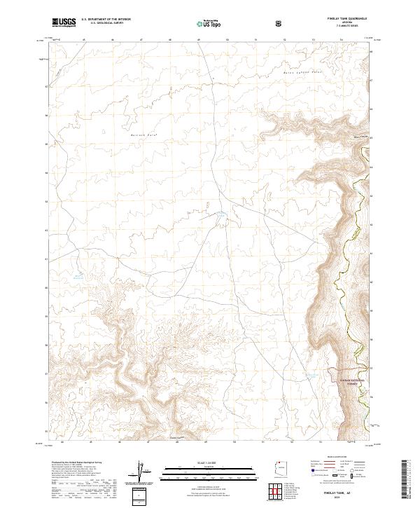
2021 Map of Findlay Tank
USGS Topo · Published 2021About this map
Kaibab National Forest dominates the southeastern reaches of this high-plateau landscape, where the land falls away into the drainage systems of Kanab Cr and Water Canyon. The topography is defined by prominent escarpments such as Bulrush Point and Burnt Canyon Point, which overlook a network of seasonal water catchments vital to the arid region. These water features, including Findlay Tank, Deer Trail Tank, and Meeks Reservoir, indicate the historical and ongoing importance of livestock management and wildlife support in this remote corner of Arizona. Transportation is limited to rugged corridors like CO Hwy 109 and the Ranger Trl, reflecting the area's transition from the open rangeland of the Arizona Strip into the protected timber and canyon lands of the national forest.
Find a feature on this map
18 named features on this map. Tap any name to fly to it.
Don’t see what you’re looking for? This feature index may not catch every label — zoom into the map to look around manually.
Map Details
Editions of this 2021 Findlay Tank Map
This is the sole edition of this map. No revisions or reprints were ever made.
Other maps of this area

1886 · Kaibab
USGS Topo · 1:250,000

1953 · Grand Canyon
USGS Topo · 1:250,000

1954 · Short Creek SE
USGS Topo · 1:24,000

1954 · Heaton Knolls SE
USGS Topo · 1:24,000

1954 · Fredonia SW
USGS Topo · 1:24,000

1954 · Fredonia
USGS Topo · 1:62,500

1954 · Short Creek
USGS Topo · 1:62,500

1954 · Heaton Knolls
USGS Topo · 1:62,500

1957 · Grand Canyon
USGS Topo · 1:250,000

1957 · Jumpup Canyon
USGS Topo · 1:62,500