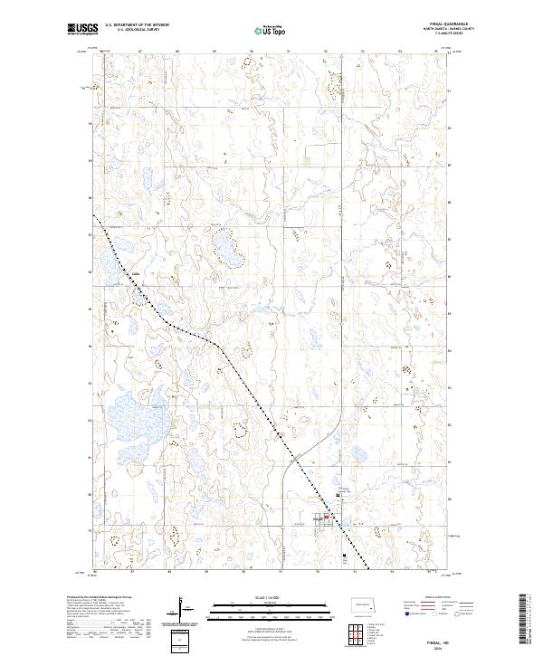
2024 Map of Fingal
USGS Topo · Published 2024About this map
The settlement of Fingal serves as the primary hub in this eastern Barnes County landscape, where the local economy and community life revolve around a grid of section-line roads and agricultural tracts. Evidence of the area's religious and communal history is found at the southern edge of the township, where the Holy Trinity Catholic Cem and Hill Side Cem are located just outside the main residential cluster. Further north, the smaller settlement of Cuba is situated along the rural road network, which includes 123rd Ave SE and 41st St SE. The map clearly delineates the Public Land Survey System boundaries, including t138n r56w and t139n r57w, showing how the prairie was systematically divided for settlement.
Find a feature on this map
26 named features on this map. Tap any name to fly to it.
Don’t see what you’re looking for? This feature index may not catch every label — zoom into the map to look around manually.
Map Details
Editions of this 2024 Fingal Map
This is the sole edition of this map. No revisions or reprints were ever made.
Other maps of this area

1897 · Tower
USGS Topo · 1:125,000

1953 · Fargo
USGS Topo · 1:250,000

1956 · Fargo
USGS Topo · 1:250,000

1961 · Valley City East
USGS Topo · 1:24,000

1965 · Lucca
USGS Topo · 1:24,000

1965 · Tower City SW
USGS Topo · 1:24,000

1967 · Tower City
USGS Topo · 1:24,000

1967 · Fingal
USGS Topo · 1:24,000

1967 · Fingal SW
USGS Topo · 1:24,000
1967 · Oriska
USGS Topo · 1:24,000