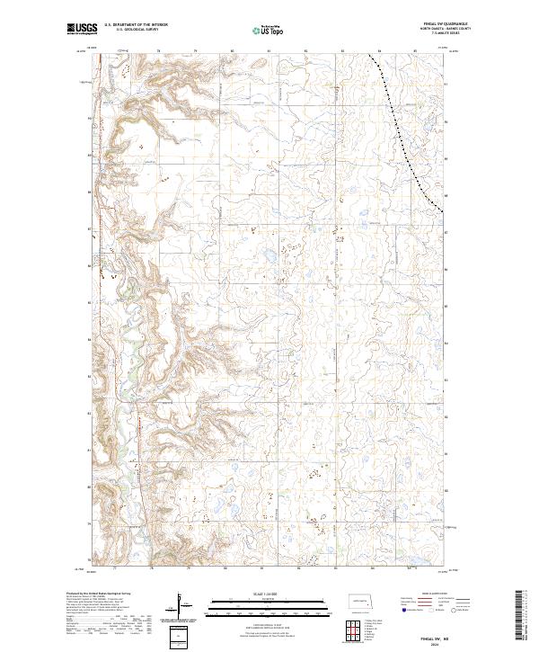
2024 Map of Fingal SW
USGS Topo · Published 2024About this map
The Sheyenne River cuts a deep, winding path through this portion of Barnes County, defining the local topography with its intricate system of draws and coulees. Along the western bluffs, the Sheyenne Valley Est indicates modern residential development overlooking the river valley, while the North Country National Scenic Trl traces the ridgeline, offering a continuous path for those following this long-distance route. This 2024 survey illustrates the intersection of traditional agricultural section lines with significant natural and recreational corridors. The landscape is largely organized by a grid of rural roads including 38th St Se and 45th St Se, which provide access to the high prairie surrounding the river's carved basin. Modern transportation is represented by Co Rd 21 and Kathryn Rd S, which connect the scattered homesteads of the Sheyenne valley to the broader region.
Find a feature on this map
15 named features on this map. Tap any name to fly to it.
Don’t see what you’re looking for? This feature index may not catch every label — zoom into the map to look around manually.
Map Details
Editions of this 2024 Fingal SW Map
This is the sole edition of this map. No revisions or reprints were ever made.
Other maps of this area

1897 · Tower
USGS Topo · 1:125,000

1897 · Eckelson
USGS Topo · 1:125,000

1953 · Jamestown
USGS Topo · 1:250,000

1953 · Fargo
USGS Topo · 1:250,000

1956 · Fargo
USGS Topo · 1:250,000

1956 · Jamestown
USGS Topo · 1:250,000

1961 · Valley City East
USGS Topo · 1:24,000

1961 · Valley City West
USGS Topo · 1:24,000

1967 · Fingal
USGS Topo · 1:24,000

1967 · Fingal SW
USGS Topo · 1:24,000