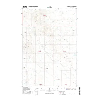
2017 Map of Finger Buttes East
USGS Topo · Published 2017About this map
Finger Buttes stand as a central landmark in this high-plains landscape of Carter County, where the topography is defined by the drainage networks of Blacktail Cr and Hay Cr. This modern survey documents the contemporary boundaries of the Public Land Survey System, specifically within the townships of t5s r60e, t6s r60e, and t6s r61e. The map reveals a sparsely settled terrain where natural landforms like Hay Draw dictate the flow of the land. It provides a technical view of the remote ranching country in southeastern Montana, detailing the subtle elevation changes and seasonal watercourses that have shaped land use in this corner of the state for generations.
Find a feature on this map
9 named features on this map. Tap any name to fly to it.
Don’t see what you’re looking for? This feature index may not catch every label — zoom into the map to look around manually.
Map Details
Editions of this 2017 Finger Buttes East Map
This is the sole edition of this map. No revisions or reprints were ever made.
Other maps of this area

1954 · Ekalaka
USGS Topo · 1:250,000

1956 · Ekalaka
USGS Topo · 1:250,000

1958 · Ekalaka
USGS Topo · 1:250,000

1965 · Ekalaka
USGS Topo · 1:250,000

1980 · Prairie Dog Creek
USGS Topo · 1:24,000
1980 · Alzada NW
USGS Topo · 1:24,000

1980 · Cactus Creek West
USGS Topo · 1:24,000

1980 · Finger Buttes East
USGS Topo · 1:24,000
1980 · Albion
USGS Topo · 1:24,000
1980 · Capitol NW
USGS Topo · 1:24,000