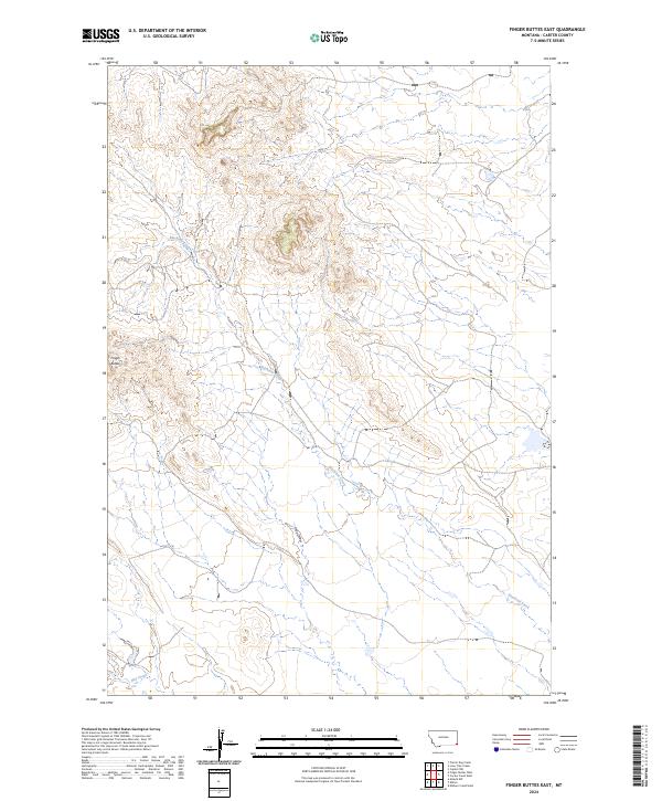
2024 Map of Finger Buttes East
USGS Topo · Published 2024About this map
Finger Buttes rises as the primary landmark in this corner of Carter County, shaping a landscape defined by sharp elevation changes and deep drainages. The area is dominated by the sprawling course of Blacktail Creek, which meanders across the township lines of t6s r60e and t6s r61e. This recent U.S. Geological Survey topographic study documents the sparse, high-plains geography where seasonal watercourses like Hay Draw and Hay Creek cut through the terrain. The map's detailed contouring reveals the complex network of draws and ridges that characterize this remote section of Montana, providing a clear view of the land's natural state before any significant modern development or industrial footprint.
Find a feature on this map
10 named features on this map. Tap any name to fly to it.
Don’t see what you’re looking for? This feature index may not catch every label — zoom into the map to look around manually.
Map Details
Editions of this 2024 Finger Buttes East Map
This is the sole edition of this map. No revisions or reprints were ever made.
Other maps of this area

1954 · Ekalaka
USGS Topo · 1:250,000

1956 · Ekalaka
USGS Topo · 1:250,000

1958 · Ekalaka
USGS Topo · 1:250,000

1965 · Ekalaka
USGS Topo · 1:250,000

1980 · Prairie Dog Creek
USGS Topo · 1:24,000
1980 · Alzada NW
USGS Topo · 1:24,000

1980 · Cactus Creek West
USGS Topo · 1:24,000

1980 · Finger Buttes East
USGS Topo · 1:24,000
1980 · Albion
USGS Topo · 1:24,000
1980 · Capitol NW
USGS Topo · 1:24,000