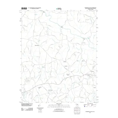
2011 Map of Fingerville East
USGS Topo · Published 2011About this map
Cooley Springs and surrounding settlements define this borderland region where South Carolina meets North Carolina. The landscape is carved by the Broad River and its numerous tributaries, including Buck Creek and Richardson Creek. This modern survey documents the rural character of the area, punctuated by a series of engineered water features such as L B Davidson Pond Dam D-3321 and Cooley Pond Dam D-2718. For local historians and genealogists, the map is a vital record of local landmarks and family resting places, including the Trinity United Methodist Cemetery, Thorne Cemetery, and Gethsemane Cemetery. Small communities like Sandy Springs and Brooklyn are mapped in detail, showing the intersection of local roads such as Dark Corner Rd and Parris Bridge Rd that have long connected these farming and residential clusters.
Find a feature on this map
145 named features on this map. Tap any name to fly to it.
Don’t see what you’re looking for? This feature index may not catch every label — zoom into the map to look around manually.
Map Details
Editions of this 2011 Fingerville East Map
This is the sole edition of this map. No revisions or reprints were ever made.
Other maps of this area

1907 · Saluda
USGS Topo · 1:125,000

1953 · Charlotte
USGS Topo · 1:250,000

1954 · Charlotte
USGS Topo · 1:250,000

1955 · Knoxville
USGS Topo · 1:250,000

1957 · Knoxville
USGS Topo · 1:250,000

1959 · Lake Lure
USGS Topo · 1:62,500

1959 · Cowpens
USGS Topo · 1:62,500

1960 · Knoxville
USGS Topo · 1:250,000

1960 · Charlotte
USGS Topo · 1:250,000

1961 · Inman
USGS Topo · 1:62,500