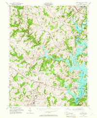
1953 Map of Finksburg
USGS Topo · Published 1967About this map
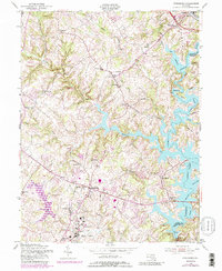
The Springfield State Hospital grounds and the sprawling waters of Liberty Lake define this central Maryland landscape during the mid-1950s. The map captures the area just as the Patapsco River valley was being transformed by the creation of the reservoir, with the Patapsco River and its numerous tributaries like Morgan Run and Beaver Run feeding into the new lake system. The Western Maryland RR snakes along the northern and southern edges, serving established communities like Finksburg and Sykesville. Local institutional history is prominent, from the Strawbridge Home for Boys to numerous rural schoolhouses and churches such as Mechanicsville Sch and Harmony Grove Ch. This documentation records the transition from a traditional agricultural and milling economy, evidenced by Glee Mill, to a region increasingly shaped by large-scale water management and state infrastructure.
Find a feature on this map
58 named features on this map. Tap any name to fly to it.
Don’t see what you’re looking for? This feature index may not catch every label — zoom into the map to look around manually.
Map Details
Editions of this 1953 Finksburg Map
5 editions found
Other maps of this area

1892 · Ellicott
USGS Topo · 1:62,500

1893 · Frederick
USGS Topo · 1:125,000

1894 · Ellicott
USGS Topo · 1:62,500

1894 · Frederick
USGS Topo · 1:125,000

1905 · Westminster
USGS Topo · 1:62,500

1906 · Ellicott
USGS Topo · 1:62,500

1908 · Patapsco
USGS Topo · 1:125,000

1909 · Mount Airy
USGS Topo · 1:62,500

1911 · Taneytown
USGS Topo · 1:62,500

1942 · Gettysburg
USGS Topo · 1:125,000