
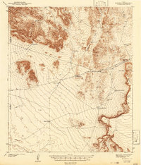
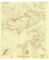
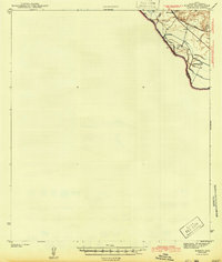
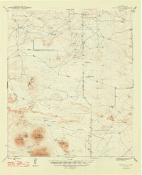
1943 Map of Finlay Mountains
USGS Topo · Published 1943About this map
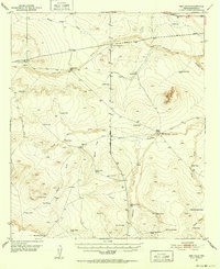
The Finlay Mountains dominate this high-desert landscape of Hudspeth County, where a complex network of ranching and rail infrastructure supported early 1940s life. The southern edge of the quadrangle is defined by the critical transportation corridor shared by the Southern Pacific and Texas and Pacific railroads, punctuated by small sidings and stops like Madden, Ramey, and Finlay. This rail line runs parallel to U. S. Route No. 80, marking the primary artery through the arid terrain.
Find a feature on this map
43 named features on this map. Tap any name to fly to it.
Don’t see what you’re looking for? This feature index may not catch every label — zoom into the map to look around manually.
Map Details
Editions of this 1943 Finlay Mountains Map
This is the sole edition of this map. No revisions or reprints were ever made.
Other maps of this area

1894 · Fort Hancock
USGS Topo · 1:125,000

1895 · Sierra Blanca
USGS Topo · 1:125,000

1903 · Cerro Alto
USGS Topo · 1:125,000
1942 · Borrego
USGS Topo · 1:62,500

1943 · Fort Quitman
USGS Topo · 1:62,500
1943 · Tepee Butte
USGS Topo · 1:62,500

1943 · Fort Hancock
USGS Topo · 1:62,500
1943 · McNary
USGS Topo · 1:62,500
1948 · Triple Hill
USGS Topo · 1:62,500
1951 · Red Hills
USGS Topo · 1:62,500