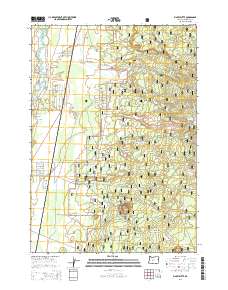
2014 Map of Finley Butte
USGS Topo · Published 2014About this map
Lapine serves as the primary settlement hub in this modern survey of the high desert landscape south of Bend. The topography is dominated by the volcanic legacy of the Newberry Volcano and prominent landmarks like Finley Butte and Mc Kay Butte. The western portion of the map follows the winding course of the Little Deschutes River, while much of the eastern terrain falls within the protected boundaries of the Deschutes National Forest. Local history and genealogy researchers will find specific interest in the presence of the Breese Cem and the Improved Order of Redmen Cem, which sit amidst the open reaches of Paulina Prairie. This map details a complex network of forest roads and local lanes, such as Newberry Road and Darlene Way, illustrating the residential growth and land management patterns of the early 21st century.
Find a feature on this map
60 named features on this map. Tap any name to fly to it.
Don’t see what you’re looking for? This feature index may not catch every label — zoom into the map to look around manually.
Map Details
Editions of this 2014 Finley Butte Map
This is the sole edition of this map. No revisions or reprints were ever made.
Other maps of this area

1930 · Maiden Peak
USGS Topo · 1:125,000

1931 · Newberry Crater
USGS Topo · 1:125,000

1934 · Maiden Peak
USGS Topo · 1:125,000

1935 · Newberry Crater
USGS Topo · 1:125,000

1955 · Crescent
USGS Topo · 1:250,000

1957 · Crescent
USGS Topo · 1:250,000

1958 · Crescent
USGS Topo · 1:250,000
1963 · Lava Cast Forest
USGS Topo · 1:24,000
1963 · Anns Butte
USGS Topo · 1:24,000

1963 · La Pine
USGS Topo · 1:24,000