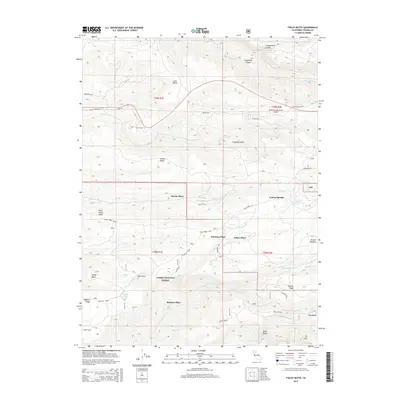
2015 Map of Finley Butte
USGS Topo · Published 2015About this map
Lassen National Forest terrain defines this section of Tehama County, where the transition from high ridgelines to deep creek drainages shapes the local landscape. The map details several historically named homesteads or locations such as Marian Place, Dantuma Place, Finley Place, and McClure Place, which likely represent earlier settlements or family holdings in this remote timber and grazing country. Significant water features like Lyman Springs and Finley Lake suggest the critical importance of reliable water sources in these elevated reaches. Infrastructure is notably centered around the Ponderosa Sky Ranch Airport and the network of forest roads like Plum Creek Road and Hogsback Road. The presence of the High Trestle indicates a specific engineering solution to the area's sharp relief, spanning the gap between Howell Ridge and Plum Creek Ridge.
Find a feature on this map
86 named features on this map. Tap any name to fly to it.
Don’t see what you’re looking for? This feature index may not catch every label — zoom into the map to look around manually.
Map Details
Editions of this 2015 Finley Butte Map
This is the sole edition of this map. No revisions or reprints were ever made.
Other maps of this area

1886 · Lassen Peak
USGS Topo · 1:250,000

1892 · Lassen Peak
USGS Topo · 1:250,000

1894 · Lassen Peak
USGS Topo · 1:250,000

1935 · Paynes Creek
USGS Topo · 1:96,000

1941 · Mineral
USGS Topo · 1:125,000
1953 · Panther Spring
USGS Topo · 1:62,500

1955 · Westwood
USGS Topo · 1:250,000

1956 · Lassen Peak
USGS Topo · 1:62,500

1956 · Manton
USGS Topo · 1:62,500

1958 · Westwood
USGS Topo · 1:250,000