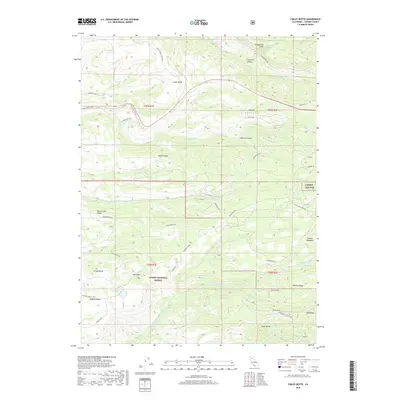
2018 Map of Finley Butte
USGS Topo · Published 2018About this map
Lassen National Forest terrain dominates this portion of Tehama County, where the landscape is defined by the complex hydrology of the Battle Creek and Antelope Creek drainages. High-altitude meadows and ridges, such as Brazell Meadows and Plum Creek Ridge, illustrate the varied topography of the southern Cascade foothills. The infrastructure of the era is marked by remote mountain access routes like Ponderosa Way and Hogback Road, alongside ranching footprints like the Oasis Springs Ranch Rd. Notable landmarks include Finley Butte and Finley Lake, providing specific points of reference for those studying the natural history of the region. This 2018 survey also identifies several spring locations, including Lyman Springs and Grapevine Spring, which were critical for early livestock operations and forest management in this arid mountain environment.
Find a feature on this map
52 named features on this map. Tap any name to fly to it.
Don’t see what you’re looking for? This feature index may not catch every label — zoom into the map to look around manually.
Map Details
Editions of this 2018 Finley Butte Map
This is the sole edition of this map. No revisions or reprints were ever made.
Other maps of this area

1886 · Lassen Peak
USGS Topo · 1:250,000

1892 · Lassen Peak
USGS Topo · 1:250,000

1894 · Lassen Peak
USGS Topo · 1:250,000

1935 · Paynes Creek
USGS Topo · 1:96,000

1941 · Mineral
USGS Topo · 1:125,000
1953 · Panther Spring
USGS Topo · 1:62,500

1955 · Westwood
USGS Topo · 1:250,000

1956 · Lassen Peak
USGS Topo · 1:62,500

1956 · Manton
USGS Topo · 1:62,500

1958 · Westwood
USGS Topo · 1:250,000