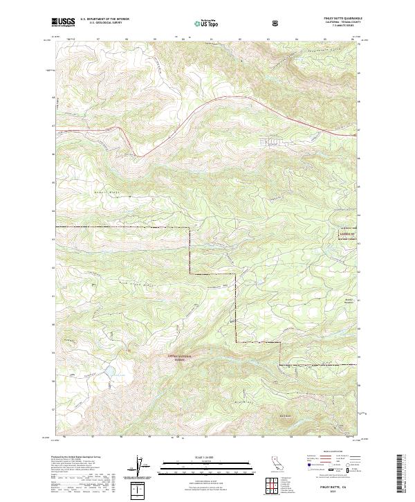
2021 Map of Finley Butte
USGS Topo · Published 2021About this map
Lassen National Forest terrain dominates this portion of Tehama County, where the landscape is defined by the complex drainage systems of the Antelope Creek and Battle Creek watersheds. High points like Finley Butte and Black Butte overlook a series of volcanic-influenced ridges and meadows, including Plum Creek Ridge and the broad Brazell Meadows. This area preserves a network of older transportation routes, most notably Old State Hwy 36 and the descriptive High Trestle Tie.
Find a feature on this map
45 named features on this map. Tap any name to fly to it.
Don’t see what you’re looking for? This feature index may not catch every label — zoom into the map to look around manually.
Map Details
Editions of this 2021 Finley Butte Map
This is the sole edition of this map. No revisions or reprints were ever made.
Other maps of this area

1886 · Lassen Peak
USGS Topo · 1:250,000

1892 · Lassen Peak
USGS Topo · 1:250,000

1894 · Lassen Peak
USGS Topo · 1:250,000

1935 · Paynes Creek
USGS Topo · 1:96,000

1941 · Mineral
USGS Topo · 1:125,000
1953 · Panther Spring
USGS Topo · 1:62,500

1955 · Westwood
USGS Topo · 1:250,000

1956 · Lassen Peak
USGS Topo · 1:62,500

1956 · Manton
USGS Topo · 1:62,500

1958 · Westwood
USGS Topo · 1:250,000