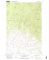
1968 Map of Finn
USGS Topo · Published 1978About this map
Helena National Forest dominates the upper half of this 1968 survey, where the rugged terrain of Dalton Mountain gives way to a network of steep drainages including California Gulch and McClellan Gulch. The landscape reflects a legacy of high-altitude resource extraction, evidenced by scattered Prospect sites and the Wiggins Mine. A Lookout Tower stands at the crest of the divide, overseeing the transition from timbered slopes to the valley floor.
Find a feature on this map
31 named features on this map. Tap any name to fly to it.
Don’t see what you’re looking for? This feature index may not catch every label — zoom into the map to look around manually.
Map Details
Editions of this 1968 Finn Map
3 editions found
Other maps of this area

1889 · Helena
USGS Topo · 1:250,000

1893 · Helena
USGS Topo · 1:250,000

1899 · Helena
USGS Topo · 1:250,000

1903 · Helena
USGS Topo · 1:250,000

1947 · Butte
USGS Topo · 1:250,000

1958 · Butte
USGS Topo · 1:250,000

1958 · Avon
USGS Topo · 1:62,500

1958 · Garrison
USGS Topo · 1:62,500

1960 · Butte
USGS Topo · 1:250,000

1962 · Butte
USGS Topo · 1:250,000