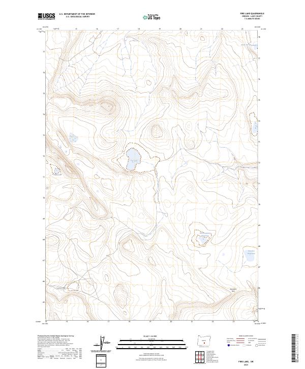
2023 Map of Fire Lake
USGS Topo · Published 2023About this map
Diatomite Mine sits at the base of the high desert slopes in this corner of Lake County, signifying the industrial extraction of ancient seabed minerals from the Oregon landscape. The area is defined by a series of critical water sources essential for life and livestock in an otherwise arid environment, including the centrally located Fire Lake and the nearby Depaoli Lake. Topography is dominated by the dramatic rise of Saunders Rim to the southeast, while a network of resource points like Saunders Waterhole, West Saunders Waterhole, and North DC Waterhole are scattered across the township boundaries. This 2023 survey illustrates the continued importance of these named water features and mining operations in a sparsely populated region of the Pacific Northwest.
Find a feature on this map
13 named features on this map. Tap any name to fly to it.
Don’t see what you’re looking for? This feature index may not catch every label — zoom into the map to look around manually.
Map Details
Editions of this 2023 Fire Lake Map
This is the sole edition of this map. No revisions or reprints were ever made.
Other maps of this area

1955 · Crescent
USGS Topo · 1:250,000

1955 · Klamath Falls
USGS Topo · 1:250,000

1957 · Crescent
USGS Topo · 1:250,000

1958 · Crescent
USGS Topo · 1:250,000

1958 · Klamath Falls
USGS Topo · 1:250,000

1970 · Crescent
USGS Topo · 1:250,000

1974 · Lake Abert
USGS Topo · 1:100,000
1984 · Poverty Basin South
USGS Topo · 1:24,000
1984 · Poverty Basin North
USGS Topo · 1:24,000

1984 · Horse Mtn
USGS Topo · 1:24,000