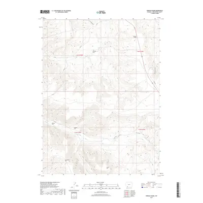
2017 Map of Firehole Basin
USGS Topo · Published 2017About this map
Firehole Basin and the prominent Sheep Mtn anchor this high-desert landscape in Sweetwater County. The topography is defined by a complex system of seasonal drainages and canyons, including the notable Firehole Canyon in the northeast and a series of western draws such as Johnson Draw, Faulkner Draw, and Greasewood Draw. These erosional features demonstrate the arid character of the Wyoming terrain, where intermittent water sources like Sage Cr and Spring Cr have carved deep into the earth.
Find a feature on this map
20 named features on this map. Tap any name to fly to it.
Don’t see what you’re looking for? This feature index may not catch every label — zoom into the map to look around manually.
Map Details
Editions of this 2017 Firehole Basin Map
This is the sole edition of this map. No revisions or reprints were ever made.
Other maps of this area

1954 · Rock Springs
USGS Topo · 1:250,000

1957 · Currant Creek Ranch
USGS Topo · 1:62,500

1957 · Firehole Basin
USGS Topo · 1:62,500

1958 · Rock Springs
USGS Topo · 1:250,000

1962 · Rock Springs
USGS Topo · 1:250,000
1963 · Maxon Ranch
USGS Topo · 1:24,000

1966 · Firehole Basin
USGS Topo · 1:62,500

1966 · Currant Creek Ranch
USGS Topo · 1:62,500
1968 · Earnest Butte
USGS Topo · 1:24,000
1968 · Kappes Canyon
USGS Topo · 1:24,000