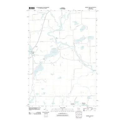
2010 Map of Fireside Lakes
USGS Topo · Published 2010About this map
The Chippewa River meanders through this portion of Rusk County, anchoring a landscape defined by an intricate network of glacial lakes and flowages. Near the settlement of Island Lake, the Island Lake WP363 Dam regulates the water levels, while the nearby Island Lake Cemetery and Mud Lake Cemetery offer points of interest for genealogists tracing local families. The southern portion of the map is dominated by the Willow Creek Flowage Number One and Willow Creek Flowage Number Two, created by several dams along Willow Creek.
Find a feature on this map
68 named features on this map. Tap any name to fly to it.
Don’t see what you’re looking for? This feature index may not catch every label — zoom into the map to look around manually.
Map Details
Editions of this 2010 Fireside Lakes Map
This is the sole edition of this map. No revisions or reprints were ever made.
Other maps of this area

1948 · Weyerhauser
USGS Topo · 1:48,000

1948 · Ladysmith
USGS Topo · 1:48,000

1949 · Bloomer
USGS Topo · 1:62,500

1950 · Weyerhauser
USGS Topo · 1:48,000

1950 · Ladysmith
USGS Topo · 1:48,000

1951 · Bloomer
USGS Topo · 1:62,500

1951 · Cornell
USGS Topo · 1:62,500

1953 · Rice Lake
USGS Topo · 1:250,000

1959 · Rice Lake
USGS Topo · 1:250,000
1971 · Thornapple
USGS Topo · 1:24,000