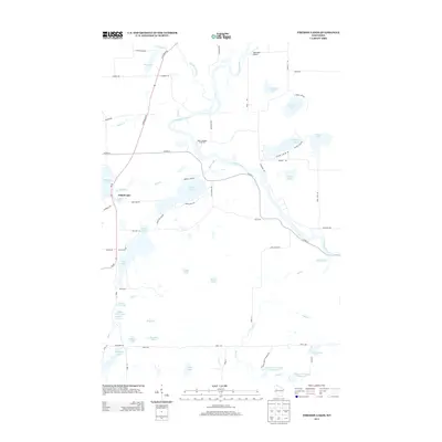
2013 Map of Fireside Lakes
USGS Topo · Published 2013About this map
Chippewa River meanders through the central and eastern portions of this Rusk County landscape, defining a region rich with glacial water bodies and seasonal landings. The map centers on the namesake Fireside Lakes, flanked by smaller water features like School Lake and Island Lake. These lakes are connected by a network of minor roads, including Indian Mission Rd and Fireside Lake Rd, reflecting the area's development as a recreational and residential hub in northern Wisconsin.
Find a feature on this map
72 named features on this map. Tap any name to fly to it.
Don’t see what you’re looking for? This feature index may not catch every label — zoom into the map to look around manually.
Map Details
Editions of this 2013 Fireside Lakes Map
This is the sole edition of this map. No revisions or reprints were ever made.
Other maps of this area

1948 · Weyerhauser
USGS Topo · 1:48,000

1948 · Ladysmith
USGS Topo · 1:48,000

1949 · Bloomer
USGS Topo · 1:62,500

1950 · Weyerhauser
USGS Topo · 1:48,000

1950 · Ladysmith
USGS Topo · 1:48,000

1951 · Bloomer
USGS Topo · 1:62,500

1951 · Cornell
USGS Topo · 1:62,500

1953 · Rice Lake
USGS Topo · 1:250,000

1959 · Rice Lake
USGS Topo · 1:250,000
1971 · Thornapple
USGS Topo · 1:24,000