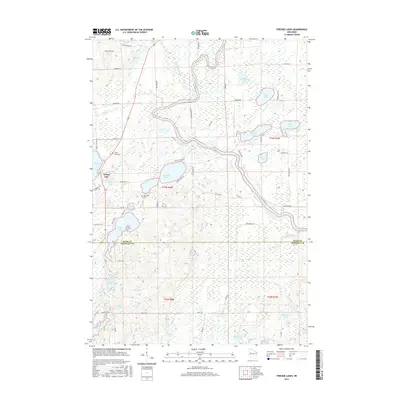
2015 Map of Fireside Lakes
USGS Topo · Published 2015About this map
Island Lake serves as a central landmark within this portion of Rusk and Chippewa counties, where a dense network of glacial lakes and wetlands defines the geography. The landscape is interconnected by the Chippewa River and its tributaries, including Rice Creek and Soft Maple Creek. The distribution of water bodies like Fireside Lakes, Sand Lake, and Pulaski Lake suggests a region primarily shaped by post-glacial drainage patterns, with many smaller ponds such as School Lake and Bog Lake interspersed throughout the forest and marshland.
Find a feature on this map
68 named features on this map. Tap any name to fly to it.
Don’t see what you’re looking for? This feature index may not catch every label — zoom into the map to look around manually.
Map Details
Editions of this 2015 Fireside Lakes Map
This is the sole edition of this map. No revisions or reprints were ever made.
Other maps of this area

1948 · Weyerhauser
USGS Topo · 1:48,000

1948 · Ladysmith
USGS Topo · 1:48,000

1949 · Bloomer
USGS Topo · 1:62,500

1950 · Weyerhauser
USGS Topo · 1:48,000

1950 · Ladysmith
USGS Topo · 1:48,000

1951 · Bloomer
USGS Topo · 1:62,500

1951 · Cornell
USGS Topo · 1:62,500

1953 · Rice Lake
USGS Topo · 1:250,000

1959 · Rice Lake
USGS Topo · 1:250,000
1971 · Thornapple
USGS Topo · 1:24,000