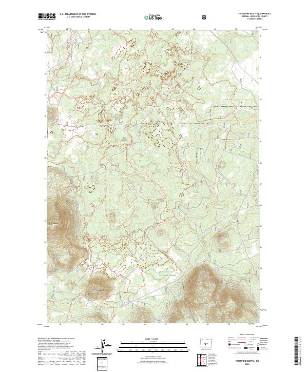
2023 Map of Firestone Butte
USGS Topo · Published 2023About this map
Deschutes National Forest land defines this central Oregon landscape, where volcanic features and an extensive network of recreation trails dominate the terrain. Significant elevations include Firestone Butte, East Butte, and Quartz Mtn, marking a region shaped by geothermal activity. The area is characterized by its geological depressions, notably The Potholes, which punctuate the high-altitude pine forests. This recent survey documents the modern infrastructure of the forest, specifically the dense concentration of off-highway vehicle routes such as Ohv #64 Trl, Ohv #80 Trl, and Ohv #70 Trl. These trails weave through the township divisions of t21s r15e and t22s r15e, reflecting the contemporary use of the land for motorized recreation within the managed timberlands of the Cascades' eastern slopes.
Find a feature on this map
30 named features on this map. Tap any name to fly to it.
Don’t see what you’re looking for? This feature index may not catch every label — zoom into the map to look around manually.
Map Details
Editions of this 2023 Firestone Butte Map
This is the sole edition of this map. No revisions or reprints were ever made.
Other maps of this area

1931 · Newberry Crater
USGS Topo · 1:125,000

1935 · Newberry Crater
USGS Topo · 1:125,000

1955 · Crescent
USGS Topo · 1:250,000

1957 · Crescent
USGS Topo · 1:250,000

1958 · Crescent
USGS Topo · 1:250,000

1966 · Millican SE
USGS Topo · 1:24,000
1967 · Evans Well
USGS Topo · 1:24,000
1967 · Pine Mountain
USGS Topo · 1:24,000

1970 · Crescent
USGS Topo · 1:250,000

1981 · Fox Butte
USGS Topo · 1:24,000