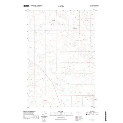
2020 Map of First Creek
USGS Topo · Published 2020About this map
Pumpkin Cr and its various tributaries define this corner of Custer County, Montana, where the drainage network creates a complex system of draws and breaks. The landscape is characterized by its sequential creek systems, including First Cr, Second Cr, and Third Cr, which carve through the terrain as they move toward larger basins. To the north, Peterson Draw sits near Johnson Cr, illustrating the typical naming conventions of local landmarks used by early ranchers and homesteaders to navigate the open range.
Find a feature on this map
15 named features on this map. Tap any name to fly to it.
Don’t see what you’re looking for? This feature index may not catch every label — zoom into the map to look around manually.
Map Details
Editions of this 2020 First Creek Map
This is the sole edition of this map. No revisions or reprints were ever made.
Other maps of this area

1953 · Miles City
USGS Topo · 1:250,000

1957 · Miles City
USGS Topo · 1:250,000

1958 · Miles City
USGS Topo · 1:250,000

1969 · Horse Creek
USGS Topo · 1:24,000

1969 · Haines Springs
USGS Topo · 1:24,000

1969 · First Creek
USGS Topo · 1:24,000

1969 · Loaf of Bread Butte
USGS Topo · 1:24,000

1969 · Beebe SW
USGS Topo · 1:24,000

1969 · Miles City Creek
USGS Topo · 1:24,000
1969 · Beebe
USGS Topo · 1:24,000