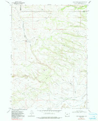
1968 Map of First Water Draw
USGS Topo · Published 1991About this map
The High Plains landscape at the boundary of Natrona and Johnson counties is defined by dramatic elevation changes and a complex network of seasonal drainages. In the late 1960s, this area was primarily characterized by its topographical transitions, including the steep Taylor Slope and the prominent Black Rim. The presence of the Thirtythree Mile Road and the Hazelton Road suggests the endurance of established cattle-driving and access routes through the basin.
Find a feature on this map
20 named features on this map. Tap any name to fly to it.
Don’t see what you’re looking for? This feature index may not catch every label — zoom into the map to look around manually.
Map Details
Editions of this 1968 First Water Draw Map
2 editions found
Other maps of this area

1952 · Deadman Butte
USGS Topo · 1:24,000

1952 · Grave Spring
USGS Topo · 1:24,000

1955 · Arminto
USGS Topo · 1:250,000

1958 · Arminto
USGS Topo · 1:250,000

1961 · Barnum
USGS Topo · 1:62,500

1962 · Arminto
USGS Topo · 1:250,000

1967 · Gordon Creek
USGS Topo · 1:24,000
1967 · Cherry Creek Hill
USGS Topo · 1:24,000

1968 · First Water Draw
USGS Topo · 1:24,000

1968 · Roughlock Hill
USGS Topo · 1:24,000