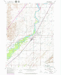
1955 Map of Firth
USGS Topo · Published 1980About this map
Agricultural development in the Snake River Valley is defined by a complex irrigation network during the mid-20th century. The Snake River bisects the landscape, its flow managed by the Great Western Canal, Peoples Canal, and the Aberdeen-Springfield Canal. These waterways supported the communities of Firth, Basalt, and Shelley, which grew along the vital transportation corridor formed by the Union Pacific Railroad and the Yellowstone Highway.
Find a feature on this map
51 named features on this map. Tap any name to fly to it.
Don’t see what you’re looking for? This feature index may not catch every label — zoom into the map to look around manually.
Map Details
Editions of this 1955 Firth Map
2 editions found

Other maps of this area

1940 · Blackfoot
USGS Topo · 1:62,500

1943 · Blackfoot
USGS Topo · 1:62,500

1948 · Woodville
USGS Topo · 1:24,000

1948 · Idaho Falls South
USGS Topo · 1:24,000

1950 · Woodville
USGS Topo · 1:24,000

1950 · Idaho Falls South
USGS Topo · 1:24,000

1950 · Goshen
USGS Topo · 1:24,000

1951 · Higham Peak
USGS Topo · 1:24,000

1952 · Goshen
USGS Topo · 1:24,000

1955 · Lincoln Creek
USGS Topo · 1:24,000