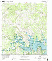
1989 Map of Fischer
USGS Topo · Published 1989About this map
Canyon Lake and the winding Guadalupe River dominate the southern landscape of this Texas Hill Country region. The 1989 revision, produced in cooperation with the Texas Water Development Board, illustrates the significant impact of the reservoir on the local geography, featuring recreation points like Potters Creek Park and Cranes Mill Park. To the north, the terrain rises toward Big Head Mountain and Kuhn Hill, where the settlement of Fischer remains a central point of interest for local history.
Find a feature on this map
29 named features on this map. Tap any name to fly to it.
Don’t see what you’re looking for? This feature index may not catch every label — zoom into the map to look around manually.
Map Details
Editions of this 1989 Fischer Map
2 editions found
Other maps of this area

1887 · Blanco
USGS Topo · 1:125,000

1894 · Blanco
USGS Topo · 1:125,000

1920 · Smithsons Valley
USGS Topo · 1:62,500

1925 · Hunter No 3
USGS Topo · 1:48,000

1925 · Smithson Valley No. 1
USGS Topo · 1:48,000

1927 · Smithson Valley
USGS Topo · 1:62,500

1929 · Hunter
USGS Topo · 1:62,500

1929 · Smithson Valley
USGS Topo · 1:62,500

1940 · Smithson Valley
USGS Topo · 1:62,500

1954 · Llano
USGS Topo · 1:250,000