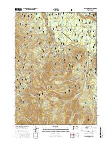
2017 Map of Fish Creek Desert
USGS Topo · Published 2017About this map
Umpqua National Forest defines this high-elevation landscape, where the Fish Creek Reservoir and the Fish Creek Canal represent the managed water resources of the Cascades. The topography is defined by significant features like The Jumpoff and Rhododendron Ridge, while the Toketee State Airport provides a rare point of aviation infrastructure in this heavily timbered area. The settlement of Happy Valley sits on the eastern edge of the quadrangle near Watson Falls, offering a point of human history among the numerous drainages such as Slipper Creek and Black Rock Fork. For researchers, the map details an extensive network of Forest Service roads, including Nat For Dev Rd 100 and Big Camas Rd, which facilitate access to remote landmarks like Whitehorse Meadows and Wolf Lake.
Find a feature on this map
82 named features on this map. Tap any name to fly to it.
Don’t see what you’re looking for? This feature index may not catch every label — zoom into the map to look around manually.
Map Details
Editions of this 2017 Fish Creek Desert Map
This is the sole edition of this map. No revisions or reprints were ever made.
Other maps of this area

1917 · Diamond Lake
USGS Topo · 1:125,000

1955 · Quartz Mtn
USGS Topo · 1:62,500

1955 · Illahee Rock
USGS Topo · 1:62,500

1956 · Toketee Falls
USGS Topo · 1:62,500

1956 · Garwood Butte
USGS Topo · 1:62,500

1958 · Roseburg
USGS Topo · 1:250,000

1959 · Roseburg
USGS Topo · 1:250,000

1978 · Diamond Lake
USGS Topo · 1:100,000
1985 · Garwood Butte
USGS Topo · 1:24,000
1985 · Hamaker Butte
USGS Topo · 1:24,000