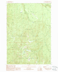
1989 Map of Fish Creek Desert
USGS Topo · Published 1990About this map
Big Camas and French Junction serve as small human footprints within the dense forest canopy of the Umpqua National Forest at the close of the 1980s. This landscape is defined by its dramatic elevation changes and managed waterways, where the Fish Creek Diversion Dam redirects flow across a terrain marked by prominent ridges like Rhododendron Ridge and high points such as Mud Lake Mountain. The map reveals the infrastructure of forest management and remote recreation, from the Toketee Airstrip to the Beaver Shelter and Canyon Camp.
Find a feature on this map
43 named features on this map. Tap any name to fly to it.
Don’t see what you’re looking for? This feature index may not catch every label — zoom into the map to look around manually.
Map Details
Editions of this 1989 Fish Creek Desert Map
This is the sole edition of this map. No revisions or reprints were ever made.
Other maps of this area

1917 · Diamond Lake
USGS Topo · 1:125,000

1955 · Quartz Mtn
USGS Topo · 1:62,500

1955 · Illahee Rock
USGS Topo · 1:62,500

1956 · Toketee Falls
USGS Topo · 1:62,500

1956 · Garwood Butte
USGS Topo · 1:62,500

1958 · Roseburg
USGS Topo · 1:250,000

1959 · Roseburg
USGS Topo · 1:250,000

1978 · Diamond Lake
USGS Topo · 1:100,000
1985 · Garwood Butte
USGS Topo · 1:24,000
1985 · Hamaker Butte
USGS Topo · 1:24,000