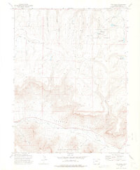
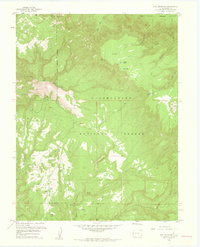
1972 Map of Fish Creek
USGS Topo · Published 1975About this map
Grand Mesa National Forest and Uncompahgre National Forest dominate this 1970s landscape, where the high-altitude terrain is defined by a complex network of canyons and water management. The northern reaches show a series of significant water works including Fruita Reservoir No 1, Fruita Reservoir No 2, and Fruita Reservoir No 3, essential for the region's agricultural and municipal needs. To the south, the deep cut of Unaweep Canyon directs the flow of West Creek, while a Mine and Gravel Pit indicate localized extraction efforts. The map records a wilderness largely accessible only by Jeep Trail, crossing through family-named landmarks like Tommy Dodson Canyon and Turner Gulch. These trails and drainages such as Little Dolores River provide a detailed look at the backcountry infrastructure used for forestry and ranching before modern development expanded in the county.
Find a feature on this map
24 named features on this map. Tap any name to fly to it.
Don’t see what you’re looking for? This feature index may not catch every label — zoom into the map to look around manually.
Map Details
Editions of this 1972 Fish Creek Map
2 editions found
Other maps of this area

1949 · Gateway
USGS Topo · 1:24,000

1950 · Pine Mountain
USGS Topo · 1:24,000

1952 · Gateway
USGS Topo · 1:24,000

1956 · Moab
USGS Topo · 1:250,000

1959 · Moab
USGS Topo · 1:250,000

1960 · Moab
USGS Topo · 1:250,000
1960 · Gateway
USGS Topo · 1:62,500
1960 · Gateway
USGS Topo · 1:24,000
1960 · Pine Mountain
USGS Topo · 1:24,000

1962 · Moab
USGS Topo · 1:250,000