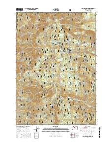
2017 Map of Fish Creek Mountain
USGS Topo · Published 2017About this map
The Clackamas River carves through this densely wooded section of the Mount Hood National Forest, revealing a landscape shaped by timber industry history and mountain geography. The presence of the Acme Timber Company Mill Pond and various National Forest Development Roads underscores the area's legacy of forest management and resource extraction. Prominent peaks such as Fish Creek Mountain and Whale Head define the high country, while several meadows including Nowhere Meadow and Wards Meadow provide clearings in the heavy forest cover.
Find a feature on this map
55 named features on this map. Tap any name to fly to it.
Don’t see what you’re looking for? This feature index may not catch every label — zoom into the map to look around manually.
Map Details
Editions of this 2017 Fish Creek Mountain Map
This is the sole edition of this map. No revisions or reprints were ever made.
Other maps of this area

1916 · Estacada
USGS Topo · 1:125,000

1924 · Mount Hood
USGS Topo · 1:125,000

1927 · Mount Hood
USGS Topo · 1:125,000

1927 · Mt. Jefferson
USGS Topo · 1:125,000

1929 · Mill City
USGS Topo · 1:125,000

1930 · Mt. Jefferson
USGS Topo · 1:125,000

1948 · Vancouver
USGS Topo · 1:250,000

1950 · Vancouver
USGS Topo · 1:250,000

1950 · Vancouver
USGS Topo · 1:250,000

1953 · Salem
USGS Topo · 1:250,000