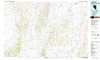
1982 Map of Fish Creek Mts
USGS Topo · Published 1983About this map
Buena Vista Valley and the Tobin Range anchor this high-desert landscape in the early 1980s, revealing a region defined by its thermal activity and mining history. Several geothermal sites, including Kyle Hot Springs, Buffalo Valley Hot Springs, and Hyder Hot Springs, are prominent landmarks across the arid basins. These springs, alongside remote water points like Sheppard Well and Pickett Wells, once served as vital stops in an environment where water dictated the possibility of human presence.
Find a feature on this map
130 named features on this map. Tap any name to fly to it.
Don’t see what you’re looking for? This feature index may not catch every label — zoom into the map to look around manually.
Map Details
Editions of this 1982 Fish Creek Mts Map
2 editions found

Other maps of this area

1908 · Carson Sink
USGS Topo · 1:250,000

1910 · Carson Sink
USGS Topo · 1:250,000

1926 · Roberts Mountains
USGS Topo · 1:250,000

1929 · Roberts Mountains
USGS Topo · 1:250,000

1931 · Lovelock
USGS Topo · 1:250,000

1932 · Sonoma Range
USGS Topo · 1:250,000

1935 · Lovelock
USGS Topo · 1:250,000

1939 · Sonoma Range
USGS Topo · 1:250,000

1940 · Antler Peak
USGS Topo · 1:62,500

1943 · Antler Peak
USGS Topo · 1:62,500