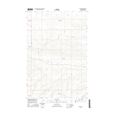
2017 Map of Fish Dam
USGS Topo · Published 2017About this map
The waters of N Fork McDonald Cr and Chippewa Cr flow through this section of Fergus County, where the landmark Fish Dam is situated along the creek's path. This landscape is defined by the rural section-line road network typical of central Montana, including Mccartney Rd and Munger Ln. The area represents a sparsely populated agricultural and ranching district where local navigation relies on landmarks like Fords Cr and Alkali Cr. Topographic details reveal the complex drainage patterns feeding into the larger creek systems, while roads such as Upper Chippewa Rd and Chippewa Creek Rd provide the primary access to the remote township and range divisions. The map preserves the exact locations of these vital water sources and access routes as they existed in the early 21st century.
Find a feature on this map
16 named features on this map. Tap any name to fly to it.
Don’t see what you’re looking for? This feature index may not catch every label — zoom into the map to look around manually.
Map Details
Editions of this 2017 Fish Dam Map
This is the sole edition of this map. No revisions or reprints were ever made.
Other maps of this area

1889 · Big Snowy Mountain
USGS Topo · 1:250,000

1893 · Big Snowy Mountain
USGS Topo · 1:250,000

1941 · Judith Peak
USGS Topo · 1:62,500

1944 · Judith Peak
USGS Topo · 1:62,500

1954 · Roundup
USGS Topo · 1:250,000

1954 · Lewistown
USGS Topo · 1:250,000

1958 · Roundup
USGS Topo · 1:250,000

1959 · Lewistown
USGS Topo · 1:250,000

1970 · Forestgrove
USGS Topo · 1:24,000

1978 · Lewistown
USGS Topo · 1:100,000