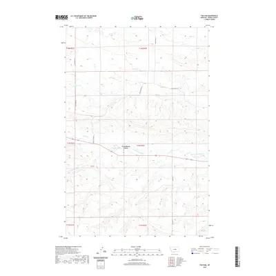
2020 Map of Fish Dam
USGS Topo · Published 2020About this map
Ayers Ranch Colony occupies a central position in this Fergus County landscape, where the prairie is defined by a network of seasonal watercourses and rural thoroughfares. The settlement pattern here reflects the agricultural communalism of the region, situated along the southern banks of Alkali Cr. The terrain is shaped by the drainage systems of N Fork McDonald Cr and Chippewa Cr, which carve through the high plains. A series of secondary routes, including Upper Chippewa Rd and McCartney Rd, connect isolated ranches and grazing lands. The area near Fish Dam illustrates the vital relationship between water management and survival in the semi-arid Montana interior. This survey captures the essential infrastructure of modern ranching and communal living at the start of the 2020s.
Find a feature on this map
17 named features on this map. Tap any name to fly to it.
Don’t see what you’re looking for? This feature index may not catch every label — zoom into the map to look around manually.
Map Details
Editions of this 2020 Fish Dam Map
This is the sole edition of this map. No revisions or reprints were ever made.
Other maps of this area

1889 · Big Snowy Mountain
USGS Topo · 1:250,000

1893 · Big Snowy Mountain
USGS Topo · 1:250,000

1941 · Judith Peak
USGS Topo · 1:62,500

1944 · Judith Peak
USGS Topo · 1:62,500

1954 · Roundup
USGS Topo · 1:250,000

1954 · Lewistown
USGS Topo · 1:250,000

1958 · Roundup
USGS Topo · 1:250,000

1959 · Lewistown
USGS Topo · 1:250,000

1970 · Forestgrove
USGS Topo · 1:24,000

1978 · Lewistown
USGS Topo · 1:100,000